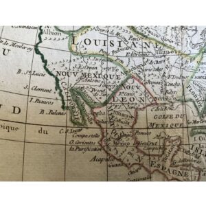
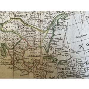
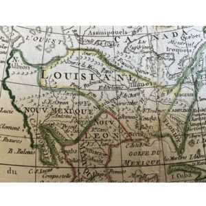

- North America. During the revolutionary war.
- 1778. By J. De Laporte.
- From ‘Atlas Moderne Portatif’. Paris.
- The most interesting aspect of the map is ‘Mer de Ouest’ a massive fictional inland sea located in the Pacific Northwest region, with islands.
- Also shows the Northwest passage.
- Alaska is unknown, but a group of unidentified islands are located in its place.
- Being a French made map, a massive Louisiana territory covers areas further west then actually occupied by the French or recognized by any other nation. The rebellious thirteen colonies are on the eastern seaboard.
- A large Mexico is divided into two parts with ‘Nova Mexique’ area includes modern American states of California, Arizona, New Mexico, Colorado, Nevada, with Texas in Nuevo León.
- Two Native Americans are a part of the decorative cartouche.
- Hand colored, copperplate engraved.
- 9” x 7”
- Excellent condition.
- Authenticity guaranteed.


1778, North America during the Revolutionary War by J. De Laporte
$316.00
16 people are viewing this product right now
1778, North America during the Revolutionary War by J. De Laporte