")
")
")
")

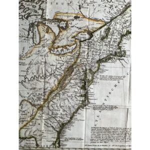
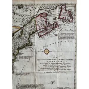
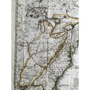
A Detailed Look at Colonial Era America and Canada During the French and Indian War
This 1754/55 map by I. Tirion, published in Amsterdam in the Nieuwe en boknopne hand-atlas, offers a detailed view of the eastern part of North America during the French and Indian War. The map depicts disputed territories, with French claims marked by dashed lines and British claims by dotted lines, highlighting the tensions of the era. It provides a fascinating glimpse into colonial America, from the Mississippi and Ohio Rivers to the Allegheny and Appalachian Mountains.
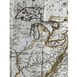
Beautifully Detailed with Fictional Islands and Frontier Fortifications
In addition to its geographic accuracy, the map includes intriguing fictional islands in Lake Superior, adding a whimsical touch to this historical piece. It also details colonial settlements, towns, cities, Native American villages, and both British and French frontier fortifications. Whether you are a history enthusiast or a map collector, this map serves as a rich source of information on the colonial period.
Exquisite Craftsmanship and Condition
Measuring 18 x 14 1/2 inches, this original hand-colored, copperplate-engraved map is in excellent condition. Its authenticity is guaranteed, making it a valuable collectible for anyone interested in the history of North America or cartography.