")
")
")


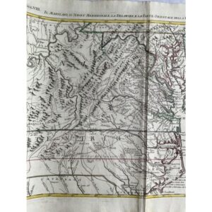
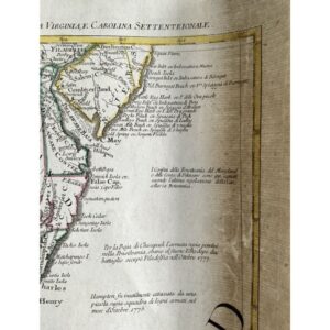
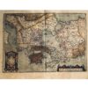
A Detailed View of British Possessions in the Mid-Atlantic
This 1780 map by A. Zatta, published in Venice as part of the “Atlante Novissimo,” offers a highly detailed representation of the British possessions in the Mid-Atlantic during the colonial era. Based on J. Mitchell’s influential North America map, this piece was crucial in territorial disputes and provided a detailed view of the region from Philadelphia to Cape Lookout in South Carolina. The map covers key geographic features like the Allegheny Mountains, the Ohio River, as well as cities, towns, and roads with exceptional accuracy.
Historical Significance and Lasting Use
This map is not just a relic of the past but a tool of history. Zatta divided his maps into 12 parts to incorporate even more detail than the original Mitchell map. In fact, this particular map was still used as a reference in boundary disputes as late as 1932 between New Jersey and Delaware, underscoring its lasting importance. It’s a remarkable piece for those interested in the history of North America and colonial-era territorial divisions.
Exceptional Craftsmanship and Condition
Measuring 17 x 12 1/2 inches, this original hand-colored, copperplate-engraved map is in excellent condition, showcasing both artistic beauty and historical accuracy. Its authenticity is guaranteed, making it an exceptional addition to any collection of colonial-era maps or American history.