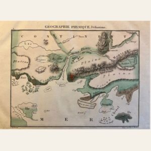
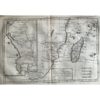
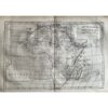
🗺️ 1775-1780 West Africa, Ocean Currents by Bonne & Raynal
- 1775-1780
- By R. Bonne and Raynal
- From ‘Histoire Philosophique et Politique des Etablissemens …’
- Part of an important work from the Age of Enlightenment, with contributions from Diderot. The questions, statements, and issues raised in the work on subjects such as religion, commerce, slavery, and contemporary political and social issues resulted in the publication being banned in France.
- As a result, it was published in Geneva, Switzerland.
- Copperplate engraved
- Authenticity Guaranteed
- Overall, very good condition
- 9 1/2 ” x 14 1/2”
This map showcases West Africa, specifically the coast of Guinea, along with ocean currents. Created by R. Bonne and Raynal between 1775 and 1780, it is part of the “Histoire Philosophique et Politique des Etablissemens” collection, which is a significant work from the Age of Enlightenment featuring contributions from Diderot. The map explores various topics such as religion, commerce, slavery, contemporary political, and social issues, leading to its banning in France. Consequently, it was published in Geneva, Switzerland. This copperplate engraved map comes with a guarantee of authenticity and is overall in very good condition, measuring 9 1/2 inches by 14 1/2 inches.