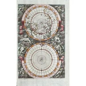
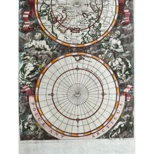
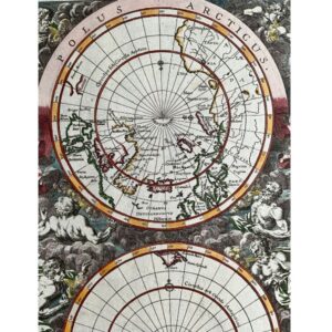
- c1700
- North and South Poles in vertical orientation
- By P. Van der Aa
- Amsterdam
- An uncommon vertical map shows only Tierra del Fuego as the land mass in the South Pole region. North Pole region shows the fictional Anian region and the partial coastline of Nouvaya Zemla
- Magnificent wind heads surrounded by clouds decorate the map
- Hand colored copperplate engraved
- 8 1/4” x 12 2/3”
- Excellent condition
- Authenticity Guaranteed
Dating back to around 1700, a vertical map of the North and South Poles was crafted by P. Van der Aa in Amsterdam. This unique map showcases only Tierra del Fuego as the landmass in the South Pole region, while the North Pole region features the fictional Anian region and partial coastline of Nouvaya Zemla. Notably, magnificent wind heads surrounded by clouds adorn the map. Created through hand-colored copperplate engraving, this map measures 8 1/4 x 12 2/3 inches and is in excellent condition, with guaranteed authenticity.